|
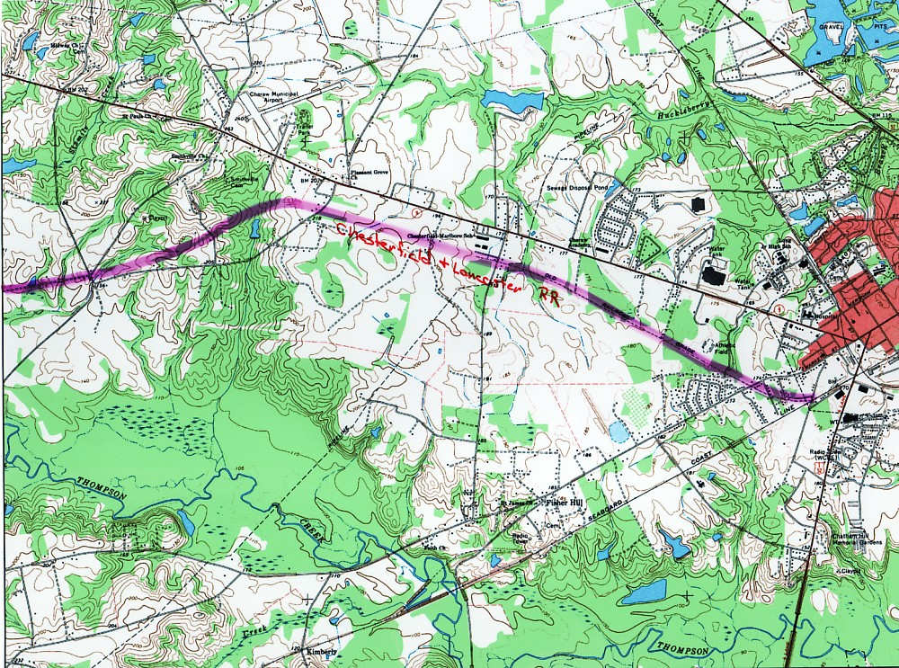
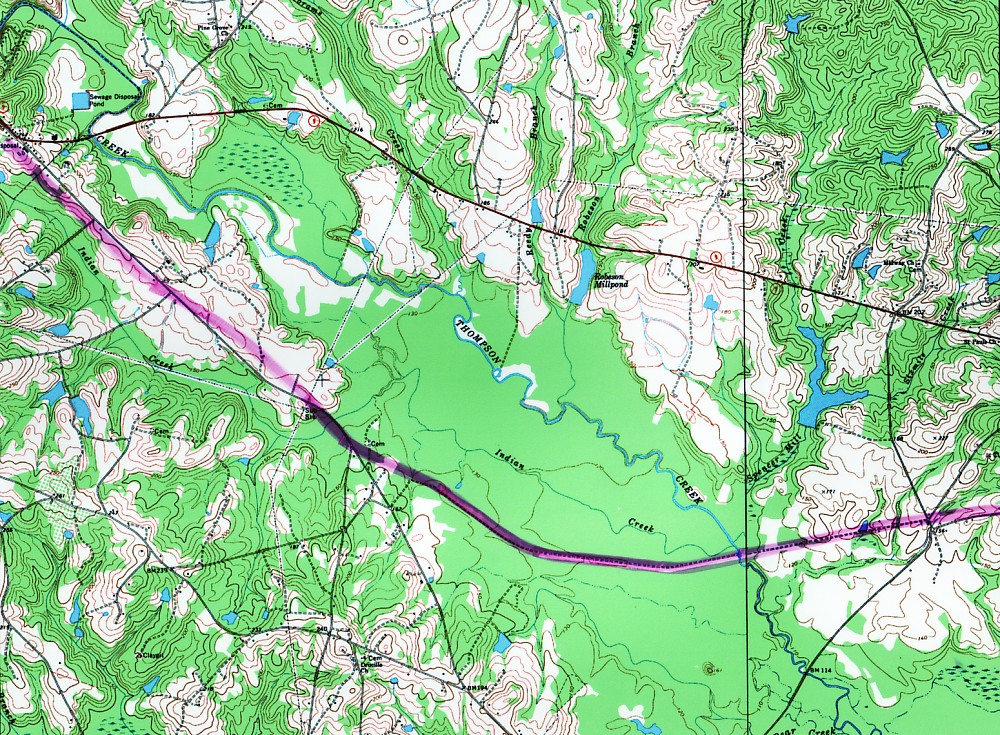
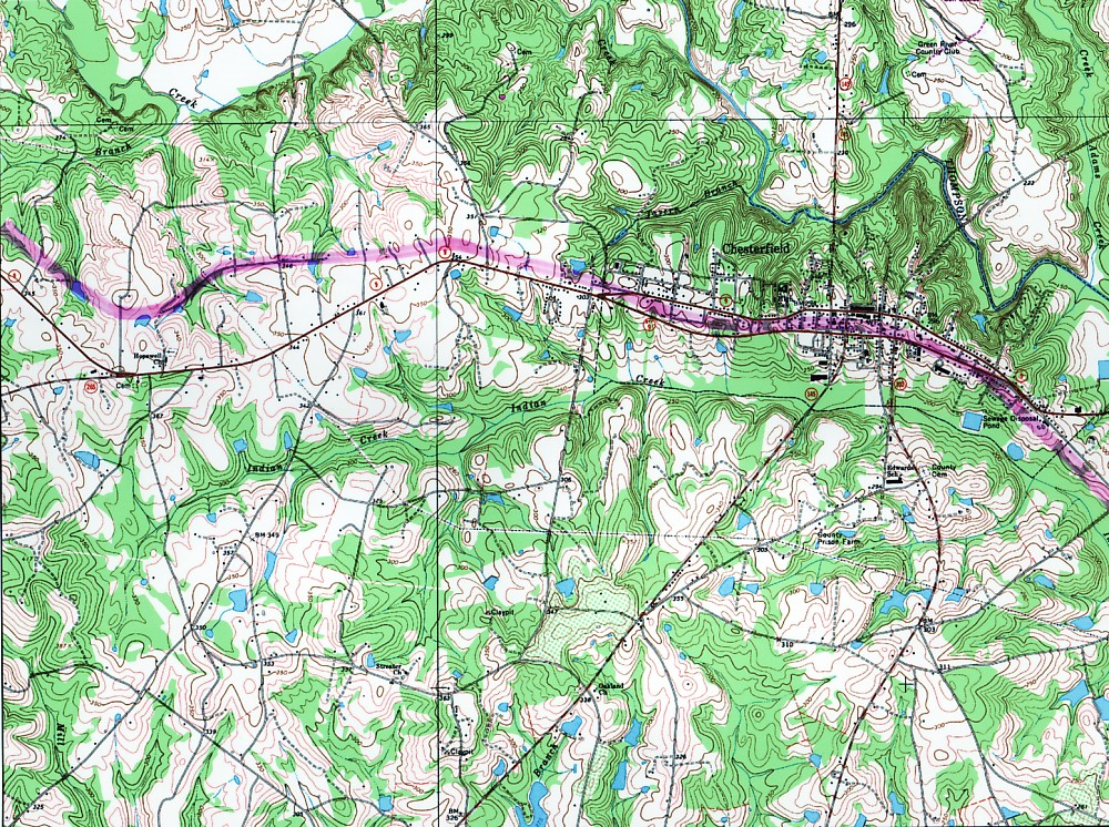
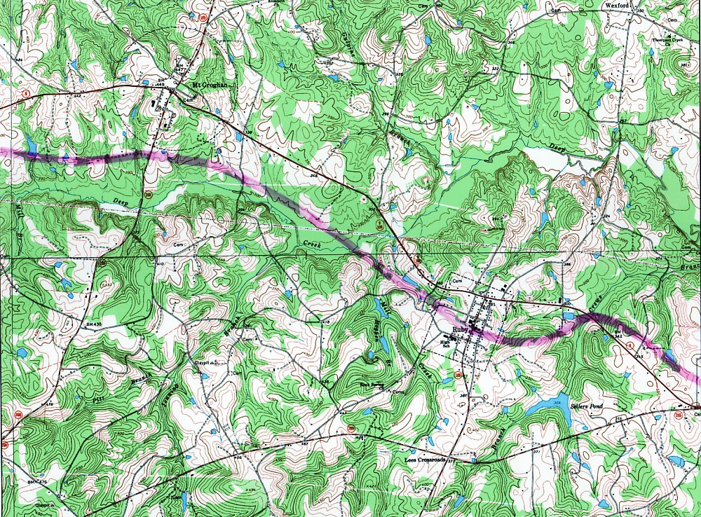
Chesterfield and Lancaster My interest in the Chesterfield and Lancaster Railroad was piqued when I went to visit a friend in a nearby neighborhood. When inquired about the large earthen dike that bordered their backyard, they responded, "It was probably a dam for a large lake that once existed here." Actually, it was a portion of the earthworks for the railroad. The C&L was built in the early 1900's and served to connect Chesterfield County (SC) from east to west. It originated in Cheraw (map 1, below) behind the current location of the IGA (grocery) store and ended near the banks of Lynches River just past the town of Pageland. Actually, the town of Pageland is named for Mr. Page, of Cheraw, the builder of the railroad. Towns such as Chesterfield, Ruby, and Mt. Croghan flourished during the early part of the century in no small part due to the presence of the line. Lore has it that when the railroad went bankrupt in the 1940's, the rail was taken up and sold to Japan as scrap. Subsequently, they made bombs out of it. The route from Cheraw to just beyond Mt. Croghan is traced-out on the four maps below. Click on a map to see a full-size image.
|
|||
 |
 |
 |
 |